
Medford Neighbors by Parcel
The dependable unit for a block search is a parcel, not an assumed household. Start with the parcel that contains the known address, then compare the adjoining parcel geometry and the owner-of-record information for each selected parcel. A tax card can identify the owner, site, mailing destination, value, and parcel identifiers. It does not establish who is presently at the address. A deed can add a dated transfer trail, while a historical street section can show a past address sequence. Each source should be read for the narrow question it can answer.
| Source | What It Shows About a Block | Access |
|---|---|---|
| AxisGIS | Parcel boundaries, streets, selected public layers, adjacency, and map identifiers | Public viewer; tools and layers require live checking |
| Medford VGSI | Owner of record, taxable site, mailing destination, value, sale, and parcel fields | Public property database; dynamic search form |
| MassLandRecords | Transfer parties, instrument, recording date, book or page, and legal description | Public Registry search with counter fallback |
| Local voter information | Public registration fields where local file rules allow disclosure | Election-office request; protected fields excluded |
| Directory street sections | Dated historical names and address or cross-street clues | Library and Historical Society collections |
| Neighborhood Ambassadors | Public civic contacts for named Medford areas | City page; not a member list |
Use the owner field as one clue, then keep site and mailing address separate. A mailing destination can be elsewhere, an entity can own a parcel, and an old directory confirms only its publication period. That distinction keeps a Medford neighbors search focused on verifiable property and civic context rather than assumptions about a household.
Note: A parcel boundary and owner field provide property context, not a complete list of people who live at or visit an address.
Medford Neighbor Boundaries
“Nearby” needs a map definition. A shared boundary means two parcels touch. A same block face means parcels front the same street segment. Those groups can differ at corners, condominium parcels, public ways, rail lines, water, or lots that face a second street. Record whether a parcel touches the target, fronts the same segment, or merely appears close on screen. Save the map date or layer vintage with that decision, because parcel geometry and public layers can change.
AxisGIS is the geographic starting point, but the Medford viewer did not expose stable tool labels, layer names, or popup fields to the research crawler. Identify, measure, rectangle-select, buffer, parcel-list, and print controls must be verified live if they are offered. A selected-parcel workflow is supported; claims about a particular button, radius tool, or map layer are not. This is why a close-looking parcel should be checked against its boundary and street frontage instead of being treated as automatically adjacent.
Note: Marking a parcel as shared-boundary or same-block-face keeps a map result from overstating who counts as a Medford neighbor.
Map Medford Neighbors Step by Step
Use the parcel map to move outward from one known address. This produces a documented set of adjoining parcels without pretending that the map displays a complete list of people. Preserve the target address, map identifier, and the reason each nearby parcel was included. Once the map reveals the parcel relationship, the assessor database can supply owner-of-record and mailing information for that specific parcel. Deed research belongs only where a particular ownership history matters.
- Locate the target address in AxisGIS and select the target parcel. Record the visible parcel identifier, street label, and map date or layer vintage.
- Zoom until parcel boundaries and street labels can be compared. Mark parcels that share a boundary separately from parcels on the same street face.
- Select each relevant surrounding parcel and record its visible identifier and taxable site. Do not infer a shared boundary from visual closeness alone.
- Return to Medford VGSI with the address or identifier to read the owner-of-record, mailing destination, and parcel details for that selected parcel.
- Use MassLandRecords only for a transfer question that matters, following the grantor, grantee, legal description, and plan references instead of relying on a modern address alone.
For a full named-street history, use the Medford street directory rather than extending an immediate-block map into an entire street roster.
The city-linked AxisGIS parcel viewer is the starting point for this selected-parcel method.
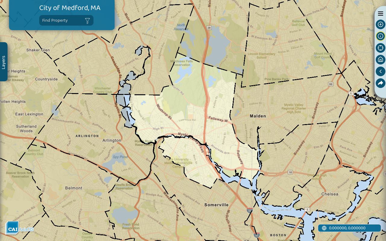
The visible parcel outlines support a boundary check, while the exact live controls and available layers should be verified in the current viewer.
Medford Neighbor Parcel Cards
Medford VGSI provides the property-card layer that follows map selection. The card can connect a parcel to an owner of record, situs, owner mailing destination, value, Vision ID or account, map or lot information, use, building attributes, and some sale information. These are tax and valuation fields. They do not prove present occupancy, identify every person at a location, or turn a tax-program flag into a household count. Keep the assessor card’s fiscal year and any sale date beside the result.
Property fields have narrow meanings. A Medford owner mailing address, voter entry, or dated directory address does not by itself prove current occupancy or enumerate everyone at the parcel.
The following Medford VGSI inputs and modes were documented in research. The dynamic interface did not expose a stable live label list, dropdown options, pagination, export behavior, or historical-year controls, so check the current form before relying on a field name or filter.
| Documented VGSI input | Format | Use or limit |
|---|---|---|
| Owner or business name | Text | Search a surname or entity, using variants and initials |
| Location or street address | Text or selection | Taxable site; number and street can be separate |
| Parcel, account, or Vision ID | Text | Use an exact identifier from the card or map |
| Map, lot, or MBLU | Text | Local parcel key; card formatting can vary |
| City, ZIP, or advanced filters | Select or text if offered | A ZIP filter was not confirmed in the crawler |
The Medford VGSI property-search screen supplies the assessor side of the parcel check.
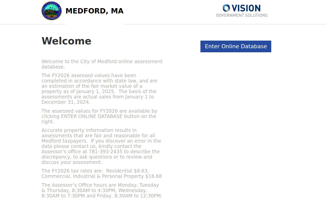
Match the selected parcel to its card, then preserve the owner, site, mailing, and date fields as separate facts.
Medford Voter Block Limits
Massachusetts My Voter Registration Status cannot browse a block anonymously. The individual status form requires first name, last name, date of birth, five-digit ZIP, and an agreement checkbox. It is designed for an individual status check, not a way to enumerate people around an address. A local public-file request is the proper route for any authorized voter-information question, and the Medford Elections Commission determines the current format, cost, and releasable fields.
State guidance identifies public local-list fields that can include name, address, party, date of birth, active or inactive status, voter ID, registration date, mailing address, and participation history. It excludes phone, email, veteran status, permanent-absentee information, confidential-voter details, and minors’ information. The statewide file has separate licensing and use rules. A partial public field set is not a complete Medford neighbor roster, and protected information must not be reconstructed from other records.
Note: The individual voter-status form is deliberately narrow and cannot be used as an anonymous block or ZIP browsing tool.
Medford Neighborhood Civic Contacts
The city’s Neighborhood Ambassadors page provides a civic layer for community questions. It names public contacts for Chair, Hillside, South Medford, North Medford, Haines Square/Glenwood, Wellington, Lawrence Estates, West Medford, and Medford Square. These are appropriate public routes for meetings, neighborhood concerns, and local communication. They are not membership lists, household lists, or an address directory. No official neighborhood-association member directory or HOA roster was located in the Medford research.
Neighborhood Ambassadors
Public city contacts for the nine named Medford areas. Use the city contact route for civic information, not private addresses.
City Boards and Commissions
Public governance and meeting channels can provide community context, but they do not establish who lives on a particular block.
Library and Historical Society
Catalogued local materials can explain a historical street or organization, with dated evidence kept separate from current parcel facts.
The official Neighborhood Ambassadors page shows the public civic-contact structure.
Its area-based contacts are useful for public community channels without suggesting that they identify every neighbor in an area.
Medford Neighbor Records Compared
Official sources and commercially compiled categories answer different questions. A parcel map or tax card comes from a named public custodian and carries a date or assessment context. A deed identifies transfer parties and a recorded document. A commercial compilation can combine public, licensed, marketing, or user-supplied information, yet its update timing and identity matching can be unclear. Treat the official record as the verification point and do not use a compiled category to fill a privacy-protected gap.
| Record category | Useful block context | Key limitation |
|---|---|---|
| Official parcel, deed, voter, and civic records | Source-specific property, transfer, authorized registration, or civic-contact facts | Each record is limited to its own purpose and date |
| Commercially compiled neighbor category | May combine data from several sources | Can attach a stale address to the wrong person or blend unrelated records |
| Historical directory or street section | Past address sequence, cross streets, and dated name context | Does not establish a current resident or parcel relationship |
When the records disagree, retain the conflict and compare dates, parcel identifiers, street frontage, and source purpose. A precise official record with a narrow claim is more useful than a broad compiled result with no clear custodian.
Historical Medford Neighbors
Historical street sections are valuable when the question is about a past block. The Medford Public Library holds city directories and voter lists from 1869 forward, with the exact annual run varying. The Medford Historical Society and Museum has selected directory volumes, municipal PDFs, and handwritten Taxpayers by Street material. The 1870–71 directory’s street section lets a reader move from a street to a sequence of entries, but a street address, cross street, “near,” corner, or West Medford notation must be read in its period.
Use a directory year as a dated snapshot. Check the alphabetical and street sections, preserve spelling and address qualifiers, then pair a later map or parcel identifier with modern records only after the street reference is normalized. A directory disappearance does not prove a move, death, or a change in every nearby parcel. The Medford Mercury microfilm and newspaper index can provide additional dated context for notices and address transitions.
Note: A historical street listing belongs to its publication year and should never be converted directly into a current neighbor roster.
Medford Neighbor Data Gaps
Some information is absent because it is private, not because a search failed. Massachusetts Address Confidentiality Program participants can use a substitute address for public and legal purposes, while covered court filings can impound the actual address. Confidential voters also receive protected treatment. Utility, delivery, private-account, DMV, and sensitive vital information are not ordinary public block records. Sealed, juvenile, expunged, impounded, and adoption court materials have their own access limits.
Keep a record of the office searched, spelling, date range, and result date. If a defined municipal file is not online, direct a narrow request to the correct custodian. Do not turn an index gap into a claim that a person is absent, and do not publish sensitive identifiers or a protected location from a record attachment.
Medford Neighbor Privacy Limits
Public availability has limits. Massachusetts anti-stalking law, M.G.L. c.265 §43, makes clear that public records do not authorize following, threatening, harassing, or exposing a protected location. Voter-file rules also limit sharing and protect confidential information. A boundary map, owner record, civic contact, or historical directory should be used only for a lawful personal purpose and never to pressure someone or defeat a confidentiality protection.
Lawful use. Use Medford neighbor records for lawful personal research and respect protected addresses, limited-access records, and each custodian’s rules. Stalking, harassment, intimidation, and attempts to uncover a confidential address are prohibited.
When a record appears wrong, contact the custodian with the document or parcel reference and the date inspected. Correcting the source is safer than repeating an unverified claim about a neighbor.